About This Project
About This Project
Overview
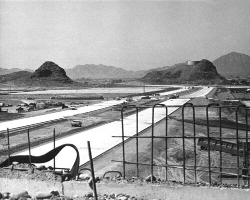
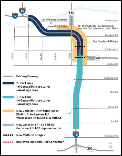
The I-10 Broadway Curve Improvement Project runs along 11 miles of Interstate 10 between the Loop 202 (Santan/South Mountain Freeway) and I-17 near Phoenix Sky Harbor International Airport. Additional work will occur on approximately one mile of east- and westbound US 60 between I-10 and Hardy Drive and on approximately one mile of north- and southbound State Route 143 between I-10 and the southern end of the SR 143 bridge over the Salt River. This is ADOT’s largest urban freeway reconstruction project. The major components include:
- Widening I-10 to six general purpose lanes and two high-occupancy vehicle (HOV) lanes in each direction between US 60 (Superstition Freeway) and I-17, and adding a fourth general purpose lane in each direction between Ray Road and US 60
- Adding Collector-Distributor roads parallel to I-10 between Baseline Road and 40th Street to separate through-traffic on I-10 from local traffic entering or exiting the highway
- Rebuilding the I-10 interchange with SR 143 to improve traffic flow and create direct connections to and from SR 143 for drivers in the I-10 HOV lanes
- Replacing the Broadway Road bridge over I-10
- Replacing the 48th Street bridges over I-10
- Widening the I-10 bridges over the Salt River
- Building two bridges for pedestrians and bicyclists over I-10 between Baseline and Broadway roads (at Alameda Drive and the Western Canal) and improving the Sun Circle Trail crossing at Guadalupe Road
- Building sound and retaining walls where warranted.
This project is being delivered as a Public-Private Partnership (P3) and Design-Build (DB). Unlike traditional design-bid-build projects, DB projects are delivered by teams that have one contract with ADOT for design and construction services. For this project, the DB team is known as the Developer. The Developer is a joint venture of Pulice Construction Inc., FNF Construction Inc. and Flatiron Constructors, Inc., known as Broadway Curve Constructors. The project designers are T.Y. Lin International Group, Stanley Consultants and Aztec Engineering.

Project History
As the designated Metropolitan Planning Organization for the Maricopa County region, the Maricopa Association of Governments (MAG) plans and funds the Regional Transportation System in Maricopa County and sections of Pinal County. This project is identified in the MAG Regional Transportation Plan (RTP), which is funded by the half-cent sales tax Maricopa County voters approved in 2004 through Proposition 400. MAG identified the need for this project to reduce travel times on I-10 during peak hours; improve airport access; support ridesharing and transit; and prepare the region for future growth projections.
The proposed improvements for the corridor have been predominately derived from the MAG “Spine” Study conducted between April 2014 and May 2017. The improvements were carried forward in an Environmental Study Process. ADOT’s study team completed an Environmental Assessment (EA) which evaluated the proposed build alternative improvements as compared to the no-build alternative. The EA was guided by the National Environmental Policy Act of 1969 (NEPA), Council on Environmental Quality (CEQ) regulations and federal and state requirements. A Finding of No Significant Impact (FONSI) was issued in April 2020, concluding the environmental process. A FONSI is a document that presents the reasons why the agency has concluded no significant impacts to the human and natural environment are projected to occur upon implementation of the project. With this environmental clearance, ADOT is proceeding with design and construction of the improvements.